

GPX tracks
In addition to the main track, you can find the MTB route and tracks for the variants with their descriptions.
All tracks are in GPX format and can be used on any GPS app or device.


Paper map
A fold-out paper map in A3 format on a scale of 1:50,000 is available.
You can pick it up at Pergola (we'll let you know where) or download it from this page in pdf format and print it.
Print possibly in color in A3 format without adapting the size to the sheet, but keeping the original size, otherwise the scale will no longer be the one indicated!
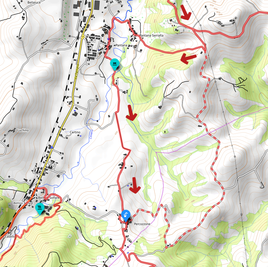
Alternative from the junction above Pantana Serralta to Percozzone
This alternative section allows you to avoid the ford at Pantana, which is generally very easy to cross in normal weather conditions.
By taking this route, you skip the hamlets of Pantana Serralta and Pantana, reaching Percozzone directly via a gravel road. In addition to the ford, you will miss out on a beautiful stretch through cultivated fields!
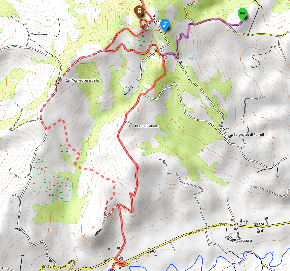
Alternative route passing by the solar farm and Monte Ghilardello
This alternative section allows you to cross the stream and reach the opposite ridge. There is an accommodation facility there that currently does not accept hikers for single-night stays; however, it has still been included and mapped.
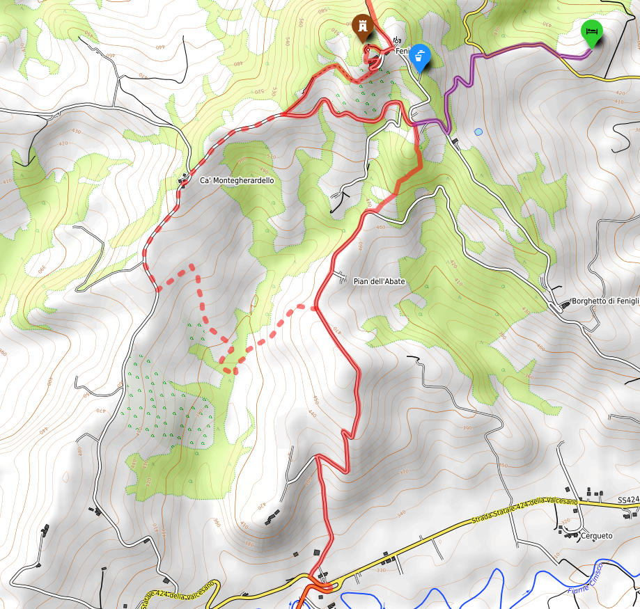
Alternative route passing by Pian dell'Abate - Monte Ghilardello - Fenigli
This alternative section allows you to cross the stream and reach the opposite ridge, where there is an accommodation facility that currently does not accept hikers for single-night stays. However, it has still been included and mapped.
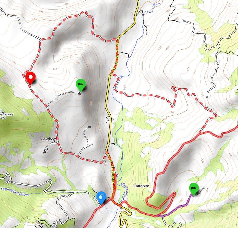
Alternative via Cartoceto, Calamello, and the Gilded Bronzes discovery site
This alternative section leads to the Calamello agriturismo and the Gilded Bronzes discovery site, located just a little further ahead. Once you reach these two locations, you can choose whether to head back to Cartoceto and resume the main track, or continue through Valle Amara to reconnect with the main route after a few kilometers.
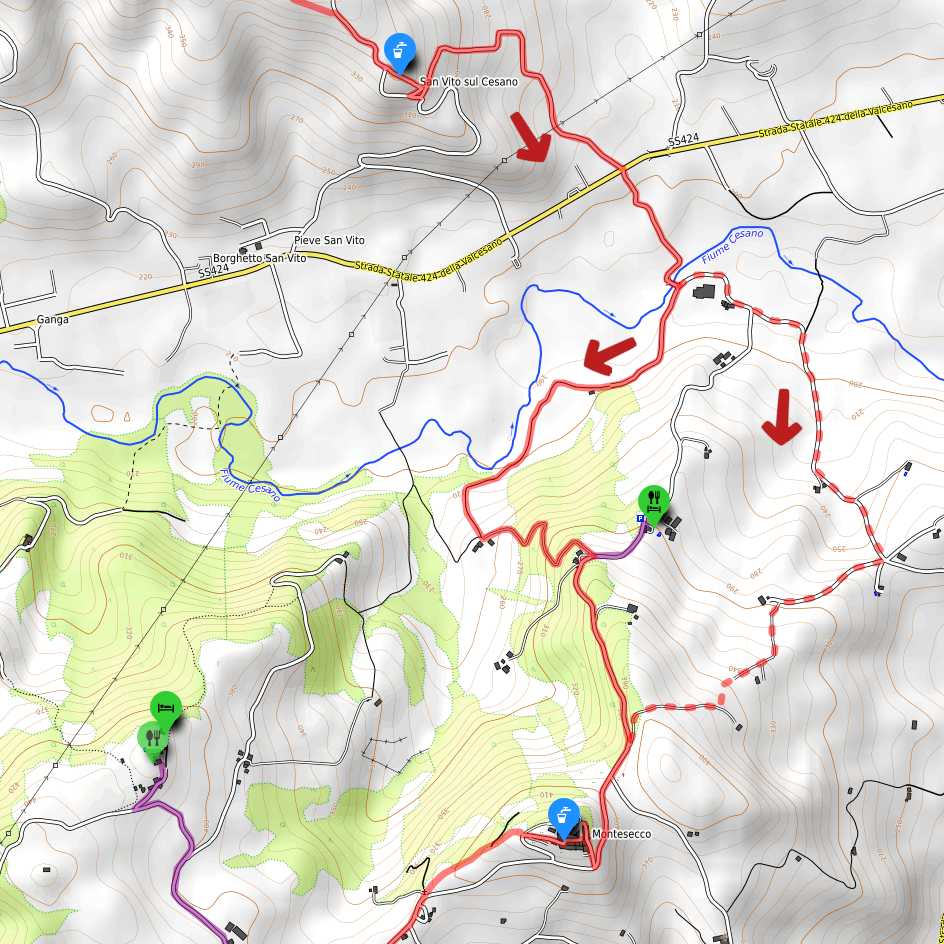
Alternative via Ponte dei Sospiri (Bridge of Sighs) – Montesecco
This alternative section reaches the Montesecco cemetery via a highly scenic viewpoint facing south (whereas the main track follows a stretch of the Cesano river). It is recommended for those who do not need to pass by the Lo Sgorzolo agriturismo.