
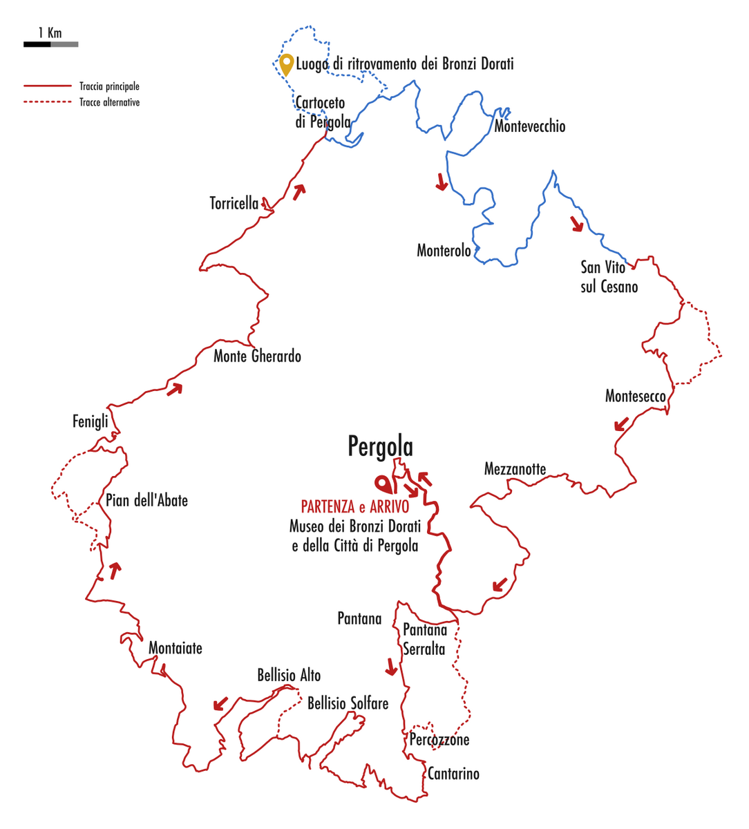
Fourth stage: from Cartoceto to San Vito sul Cesano
5:43 hours - 19.5 km - average speed 3.4 km/h - ascent 640 m - descent 540 m
- 48,69 Km Cartoceto (250m)
- 48.69 Km + detour 1800m - Agriturismo Calamello
- 48,69 Km + detour 1700m - Discovery site of the Gilded Bronzes
- 55,00 Km Chiesa di San Ghilardo
- 57,00 Km Montevecchio (490m)
- 62,40 Km Monterolo (450m)
- 63,30 Km + detour 200m - B&B Primavera
- 66,20 Km Convento della Romita (ruins)
- 68,50 Km San Vito sul Cesano (340m)
- 69,11 Km - Agriturismo Il Cuppio
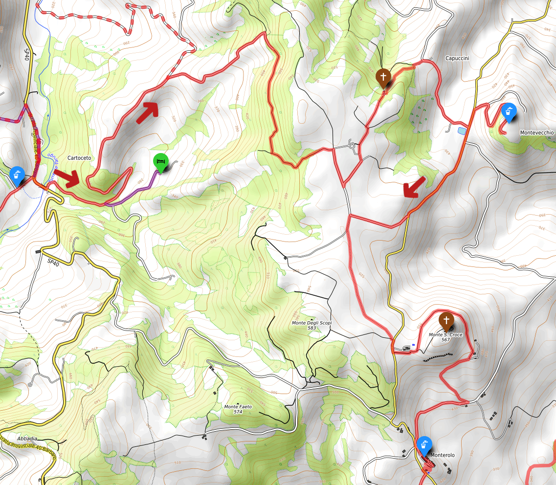
From Cartoceto di Pergola, the trail climbs first along gravel roads and then through forest tracks until it reaches Pian Rotondo, a magnificent expanse of cultivated fields offering views over the Cesano Valley all the way to the Adriatic Sea.
From here, the descent leads to the small Church of San Ghilardo, a hidden gem tucked away in the woods; the church is open and can be visited. Continuing downhill along the forest track, you will pass a small cluster of houses known as I Cappuccini. From there, following the gravel road and a short asphalt section, you reach Montevecchio.
In the main square, you will find the Circolo di Montevecchio, which is usually open on weekends—the perfect spot to quench your thirst with a cold beer! Be sure to walk to the very end of the main street to enjoy a magnificent panorama, and if you have time, take a stroll through the narrow side alleys.
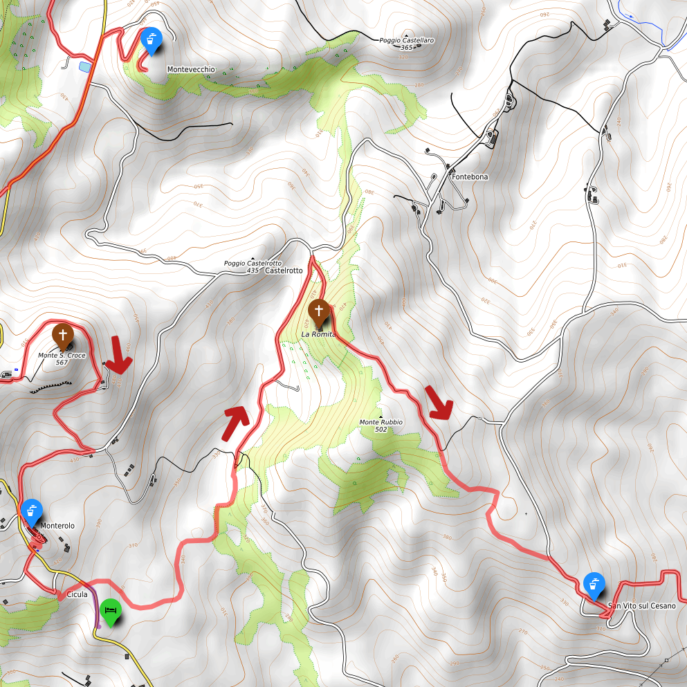
From Montevecchio, you must backtrack for a short distance along the same road before heading toward Monterolo. You will pass through Pian Rotondo once again, but this time climbing via a different path. Looking at the map, you might be tempted to take the paved road to shorten the trip to Monterolo: don’t do it! The suggested trail is much more beautiful and scenic.
After crossing the fields, the trail crosses the paved road and continues along another forest track that winds around Monte Santa Croce, a limestone plateau topped by a vast meadow.
Before taking the path that circles the mountain, you can make a quick 5 minute climb to the small church located at the edge of the large meadow. Next to the church, there is a table with two benches, offering a perfect spot to rest in the shade of the trees.
Monterolo and the Path to San Vito
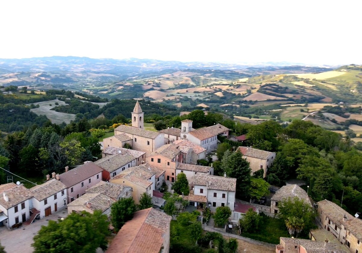
From Monte Santa Croce, head back down the same way and, after following the shaded path that leads to the opposite side, climb up to Monterolo. A journey is not just about walking... so take a moment here to wander through the narrow streets and along the walls. At the end of the village, you will find the Church of Santa Felicita with its small square and a stunning panoramic balcony atop the ancient walls: to the right, you can see the Monte Catria massif, and to the left, the Cesano Valley. In the central square, there is a water spout to refill your bottles.
The trail continues by exiting through the 15th-century "Prima Porta" (the main gate in the lower part of the village), where you can admire a fresco on the right depicting the Madonna and Child with Saint Anthony Abbot.
From the gate, a short path leads to the paved road below. Soon after, turn right toward La Cicula, a small cluster of houses. This minor detour is useful to avoid a rather narrow stretch of asphalt. From this tiny hamlet, descend back to the paved road, only to cross it and continue—passing a farm building on your left—along a beautiful track through the fields that leads to the ruins of the ancient Romita Monastery.
From here, the route climbs a forest track along the wooded slopes of Monte Rubbio, reaching a scenic viewpoint before continuing on to San Vito sul Cesano (a hamlet of San Lorenzo in Campo).
Places along this stage
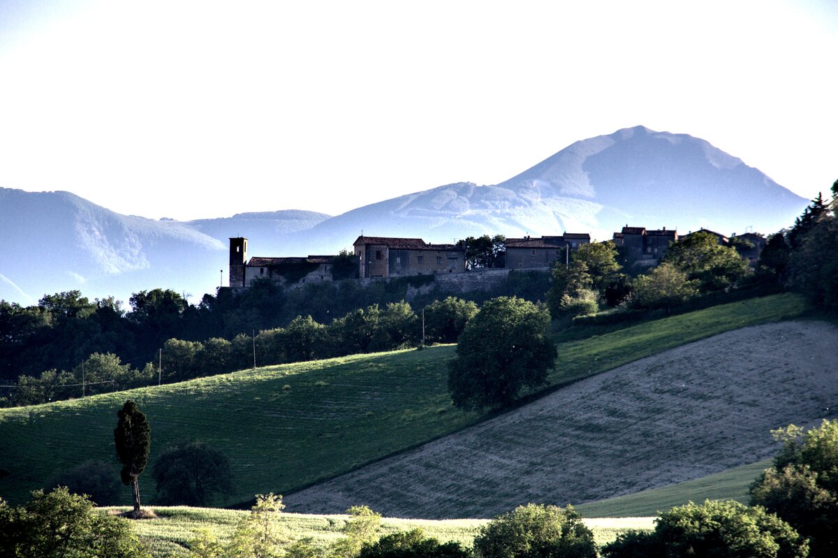
Montevecchio is a hamlet of Pergola situated on a hilltop at an altitude of about 500 meters. The village features a main street that starts from the small square, with several cross-streets branching off it; there is a church with its bell tower and the former town hall with its own tower. From this vantage point, you can enjoy a 360-degree view stretching from the Apennines (the Monte Catria massif) across the entire Cesano Valley all the way to the Adriatic Sea.
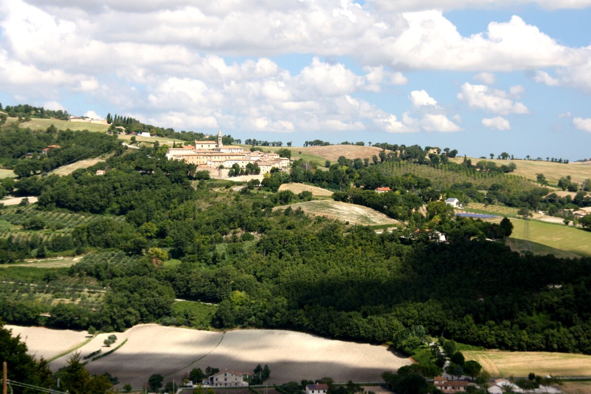
Monterolo is a hamlet of Pergola, situated at 472 m above sea level on a ridge overlooking the Cesano Valley, with Monte Santa Croce nearby. The area has been inhabited since ancient times, with archaeological finds dating back to the Umbrian, Etruscan, Celtic, and Roman eras. Documented as a castle since 1099, it was part of the Ravignana territory, under the jurisdiction of the monasteries of Ravenna. Over the centuries, it fell under the rule of Fano, then the Malatesta, Sforza, and finally the Della Rovere families, becoming part of the Duchy of Urbino. In the 17th century, it became part of the Papal States and, after the Napoleonic period, regained its autonomy until the Unification of Italy, when it was annexed to Pergola in 1869.
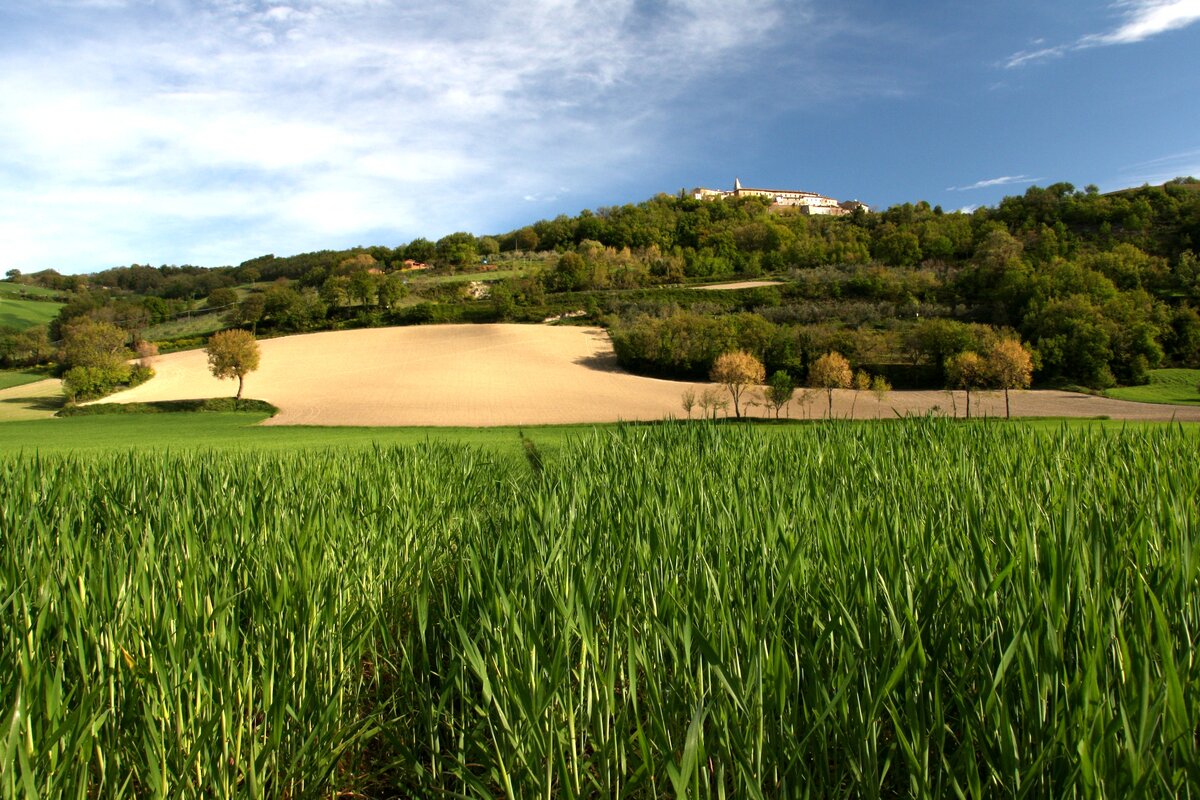
San Vito sul Cesano is a medieval village perched at the summit of a hill in the Municipality of San Lorenzo in Campo. Its prime location allows visitors to enjoy a double-sided panorama: the Cesano Valley stretching all the way to the sea on one side, and the rugged Monte Catria massif on the other.
True to its medieval origins, the village is enclosed by fortified walls, with the original entrance gate still standing in the lower section. The street layout is a classic example of a fortified settlement: a main road bisects the town, intersected by numerous narrow cross-streets and a circular lane that follows almost the entire perimeter of the walls.